5 Geological Discoveries That Shifted the Earth Beneath Our Feet
Imagine standing on solid ground and being told that the floor beneath you is moving. Not just slightly shaking during an earthquake, but actually drifting, like a slow-motion raft on a sea of molten rock. That sounds crazy, right? Yet that is exactly what a series of remarkable discoveries revealed about our planet. And the story of how scientists figured this out is as dramatic as the Earth itself.
For most of human history, people assumed the ground was fixed. Mountains were ancient. Continents sat where they always had. Geology was mostly a job of cataloguing rocks and drawing maps. Then, within a span of about 60 years, everything changed.
“The greatest obstacle to discovery is not ignorance — it is the illusion of knowledge.” — Daniel J. Boorstin
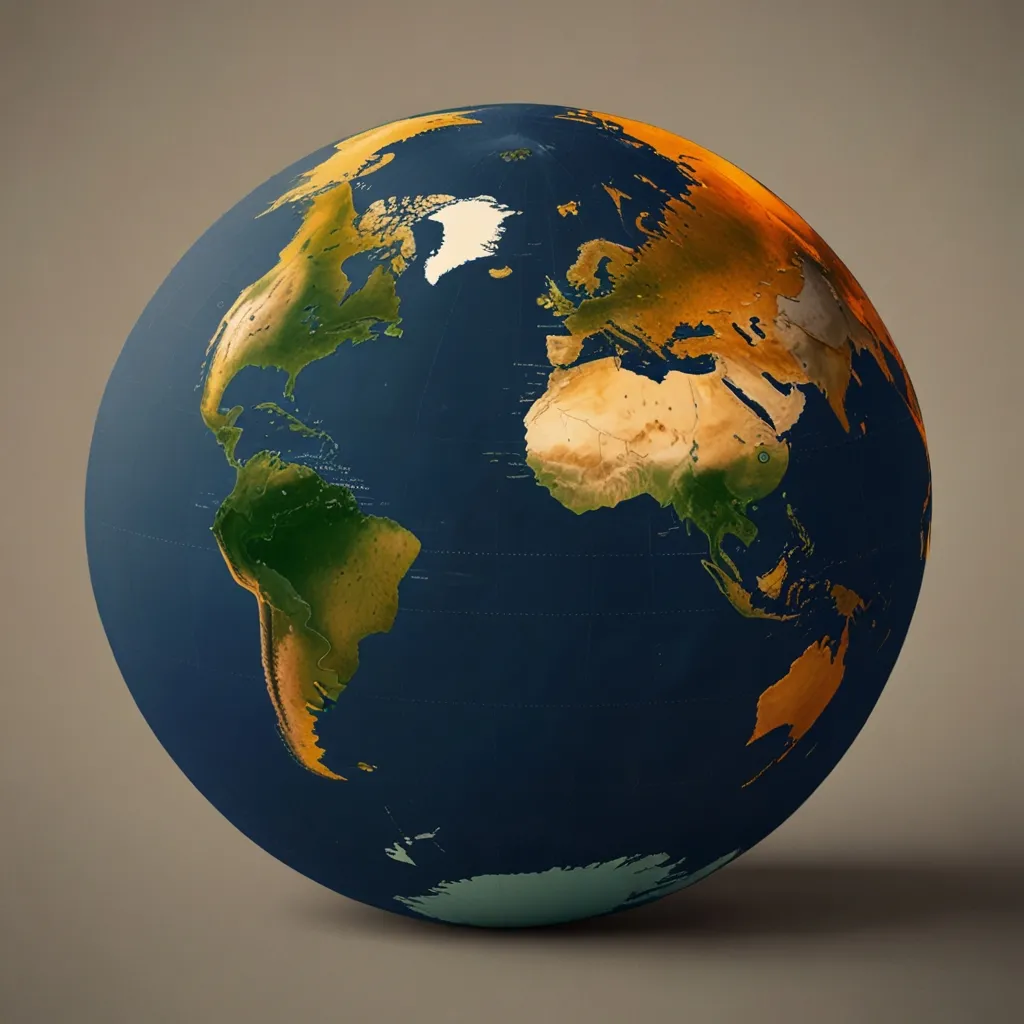
Let’s start at the beginning of this story. In 1912, a German meteorologist named Alfred Wegener made an observation that most scientists at the time considered embarrassing to take seriously. He noticed that South America and Africa looked like they could fit together, like two pieces of a jigsaw puzzle. But he didn’t stop there. He gathered evidence from fossils found on opposite sides of the Atlantic — identical species of plants and animals that had no way of crossing a vast ocean. He found matching rock formations on different continents. He pointed to climate data suggesting that some polar regions were once tropical. He called his theory continental drift and said all the continents had once been joined in a single supercontinent he named Pangaea.
Here’s the thing though — Wegener was almost universally rejected by the geology community. Not because his evidence was bad. It was actually quite compelling. The problem was simpler: he couldn’t explain how solid continents moved through equally solid ocean floor. Without a mechanism, the idea seemed physically impossible. Think of it like telling someone your car drove across town but admitting you have no engine. The destination might match, but no one will believe you made the trip.
Wegener died in 1930 during an expedition to Greenland, his life’s work still dismissed. But he had asked exactly the right question. And science has a way of eventually catching up to good questions.
So what did give continents their engine? The answer came from an unlikely place — the bottom of the ocean. During World War II, the United States Navy needed detailed maps of the seafloor to navigate submarines safely. What they got back was something nobody expected. The ocean floor wasn’t a flat, featureless plain. It had mountains, valleys, and most strikingly, a continuous chain of underwater ridges running through every ocean basin on Earth, like the seams on a baseball.
Have you ever wondered why the ocean floor is so much younger than the continents? The oldest continental rocks are over four billion years old. The oldest ocean floor? Just about 200 million years. That age gap is a giant clue.
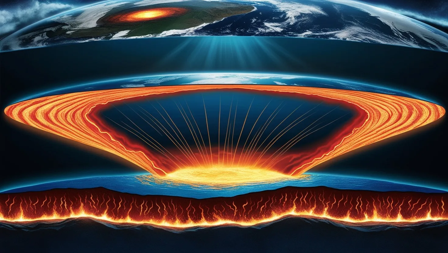
Harry Hess, a geologist who also happened to command a Navy ship, looked at these ridges and proposed something audacious in 1960. He suggested that these ridges were not just mountains sitting there. They were factories. Molten rock from the Earth’s interior was rising up through these ridges, hardening into new crust, and then slowly pushing the older crust sideways toward the edges of the ocean basins. He called this seafloor spreading. It was the engine Wegener never had. Continents weren’t plowing through the ocean floor like a ship through water. They were riding on top of spreading plates, like passengers on a very slow conveyor belt.
“Science is built up of facts, as a house is built of stones; but an accumulation of facts is no more a science than a heap of stones is a house.” — Henri Poincaré
But even Hess needed proof. And the proof came from something most people have never thought about — the Earth’s magnetic field reverses itself every few hundred thousand years. North becomes south, south becomes north. Strange but true. When molten rock hardens, the magnetic minerals inside it line up with whatever direction the Earth’s magnetic field is pointing at that moment. It’s like freezing a compass reading into stone.
In 1963, Fred Vine and Drummond Matthews were studying magnetic readings taken over the mid-ocean ridges. They noticed something extraordinary. On either side of the ridges, there were perfectly symmetrical stripes of alternating magnetic polarity. The pattern was a mirror image on both sides. This matched the known history of Earth’s magnetic reversals perfectly. The ocean floor was essentially a magnetic tape recorder, capturing the history of the Earth’s changing magnetic field as new crust formed and spread outward. This was the proof that clinched it. Seafloor spreading was real.
What do you think it felt like to look at that symmetrical magnetic stripe pattern for the first time and realize you were reading the Earth’s own diary?
Now comes one of the most important pieces of the puzzle, and it’s one that often gets overlooked. If new ocean floor is constantly being created at the ridges, why isn’t the Earth getting bigger? The planet isn’t inflating like a balloon. So where does all that old crust go?
The answer is subduction. When an ocean plate collides with another plate, one of them gets forced downward, back into the Earth’s hot interior. This happens at deep-sea trenches — the deepest places on Earth. The Mariana Trench, for example, sits above just such a subduction zone. As the descending plate heats up and melts back into the mantle, it generates volcanoes above it. This is exactly why the Pacific Ocean is ringed by volcanoes and earthquakes — the so-called Ring of Fire. It’s not a coincidence. It’s subduction happening in real time, all the way around the basin.
The elegance of this system is almost hard to believe. New crust is born at the ridges. Old crust is destroyed at the trenches. The Earth maintains a kind of geological balance, constantly recycling its own surface. And this explains something that puzzled geologists for decades — why the ocean floor is so young while the continents are so ancient. Continents, being made of lighter rock, float on top and don’t get pulled down. Ocean crust, being denser, eventually gets recycled. Continents are the survivors. Ocean floors are the rotating cast.
“We shall not cease from exploration, and the end of all our exploring will be to arrive where we started and know the place for the first time.” — T.S. Eliot
The final piece of this story is the most recent, and honestly, the most satisfying. For decades, plate tectonics was an extremely well-supported theory. But it was still, technically, a theory built on indirect evidence — magnetic stripes, fossil patterns, rock ages. Then GPS came along and changed everything.
Modern satellite geodesy uses networks of GPS sensors planted across continents and ocean islands to directly measure how fast plates are moving. And they are moving. The Australian plate moves northward at about 7 centimeters per year — faster than most other plates. The Atlantic Ocean is widening at roughly the pace your fingernails grow. These are not theoretical numbers. They are direct, measured, real-time observations.
What this has done for geology is remarkable. Scientists can now watch the Earth move with their own instruments. They can measure the strain building up along fault lines before an earthquake happens. They can track how mountains rise millimeter by millimeter. Plate tectonics moved from a theory into something you can actually watch happen.
Think about that for a moment. The ground you are standing on right now is moving. Not just in earthquakes. Always. Quietly, constantly, carrying you along for the ride.
What makes this entire story so worth paying attention to is not just the science. It’s what it says about how knowledge actually grows. Wegener was right but couldn’t prove it. Hess had the mechanism but needed confirmation. Vine and Matthews found the confirmation in magnetic stripes. Subduction solved the recycling problem. GPS turned theory into measurement. Each discovery built on the one before it, and each one required someone willing to look at familiar data in an entirely unfamiliar way.
The Earth is not the stable, ancient, unchanging platform we once imagined. It is a restless, churning, self-recycling system that has been reshaping itself for 4.5 billion years. Every mountain range, every ocean trench, every volcano tells part of that story.
And we’re still only just beginning to read it.